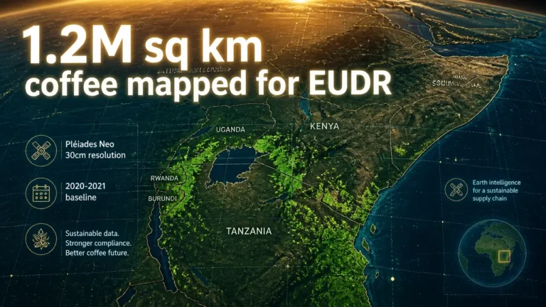

A group of major coffee traders has teamed up with satellite operator Airbus to build what they describe as the world’s first comprehensive, openly accessible global map of coffee production, launched on 22 April 2026 under the Coffee Canopy Partnership to support deforestation-free sourcing.
The initiative, led by JDE Peet’s (now part of Keurig Dr Pepper) and announced via GlobeNewswire, brings together traders Louis Dreyfus Company, Sucden, Neumann Kaffee Gruppe, Touton, Sucafina and Tchibo with Airbus in a pre-competitive collaboration. According to GlobeNewswire, the partners say the project aims for worldwide coverage of all coffee-growing regions in 2027, with a 2020–2021 baseline map and an updated 2024–2025 dataset.
The first phase focuses on East Africa, where the Partnership will map 1.2 million square kilometres across Ethiopia, Tanzania, Kenya, Uganda, Burundi and Rwanda, GlobeNewswire reported. Deliveries from this pilot are scheduled to begin in April 2026, with the full dataset expected by June 2026, providing an early test case in one of coffee’s most important producing regions.
GlobeNewswire states that the Coffee Canopy Partnership will use Airbus’s very high-resolution Pléiades and Pléiades Neo satellite imagery, with resolution up to 30 centimetres, combined with artificial intelligence and on-the-ground verification. FurtherAfrica, in its coverage of the launch, reports that this technology can identify farm boundaries and distinguish coffee plots from surrounding forest with high accuracy, even in fragmented landscapes.
A central technical challenge highlighted in the GlobeNewswire release is the risk that shade-grown coffee and agroforestry systems are misclassified as natural forest under existing monitoring tools, complicating compliance with regulations such as the European Union Deforestation Regulation (EUDR). Sprudge notes that the EUDR bars coffee grown on land deforested after 31 December 2020 from entering the EU market, with compliance deadlines now set at 30 December 2026 for large and medium companies and 30 June 2027 for micro and small enterprises after two previous delays.
Laurent Sagarra, VP Engagement at JDE Peet’s, said in the GlobeNewswire announcement that the Partnership is intended to move “beyond fragmented, company-led deforestation initiatives by fostering collaboration at a landscape scale,” and emphasised that it is “not another certification scheme” but a sector-led effort to help keep forests “vibrant” and reduce coffee-driven deforestation risk over time.
Speaking to the pre-competitive nature of the project, Neumann Kaffee Gruppe’s CEO EMEA Marten Sievers said in an FT Markets Announcement that the Partnership “proves that the coffee sector can move beyond fragmented efforts and build something genuinely shared,” arguing that working together allows companies to “evaluate what works at scale” and “raise the bar together” toward deforestation-free coffee.
On the technology side, Eric Even, Head of Space Digital at Airbus Defence and Space, told GlobeNewswire that combining the company’s high-resolution imagery with advanced AI aims to identify deforestation risk and “empower food producers and smallholder farmers with the transparency and reliable data needed to strengthen their resilience and build a truly sustainable supply chain.”
The pilot is supported by the UK Foreign, Commonwealth & Development Office through the Partnerships for Forests (P4F) programme and endorsed by the UN Food and Agriculture Organization (FAO), GlobeNewswire reported. FAO’s Julian Fox said the initiative aligns with FAO’s AIM4Commodities programme, which seeks open and inclusive data and technical solutions for sustainable commodity production.
Kate McCoy, Director at P4F, said in a Touton news release that the first phase will deliver “clear, accurate maps showing where coffee is grown and where forests are under pressure” across the six East African countries, describing it as a proof of concept that can later be scaled globally to support a “unified, landscape level approach” and improve market access for farmers.
GlobeNewswire further notes that mapping outputs will be made available to governments, communities and farmers, with full high-resolution data offered to origin-country governments at no cost, and states that all coffee-sector players are invited to join the Partnership as it moves toward its 2027 global coverage goal.